Alaska Highway Guide & Map
Alaska Highway Mile by Mile Road Log
Welcome to our Alaska Highway road description and information on towns along the highway.
There are currently no travel restrictions whatsoever. No vaccination requirements in place. Please refer to our border crossing page for more details. Enjoy your journey to Alaska! The Alcan has many attractions that are worth stopping for.
Dawson Creek BC to Delta Junction AK – 1,387 miles
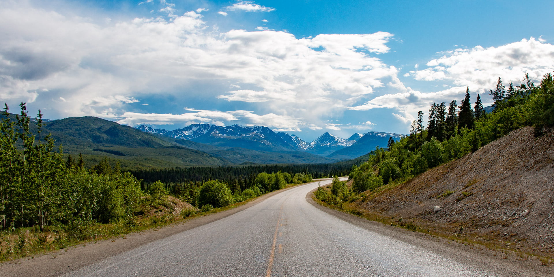
Iconic and formidable, with its own monument to boot, the Alaska Highway is an engineering marvel, an historic journey, and your most direct gateway to the Alaska. Starting in Dawson Creek, BC, this highway is suitable for all vehicles and popular with RV travellers, with enough towns, services and sights to make your road trip a breeze. Camping options and provincial parks dot the road up to the Yukon border, and wide-open vistas beckon at every turn. Be sure to stop for a soak in the Liard River Hot Springs – the perfect unwind after a long day’s drive – for your adventure is just beginning.
The Alaska Highway was originally constructed during World War II to connect the lower 48 with Alaska. It starts in Dawson Creek, British Columbia and goes north 1,387 miles ending in Delta Junction, Alaska.
The highway is completely paved but you may encounter gravel sections during the summer months when road maintenance crews are working to redo the chip seal pavement. Posted speed limits are for ideal weather conditions. Frost heaves occur throughout and you should slow down accordingly. Most road damage will be indicated by flags or signage.
In 1996 the Alaska Highway was recognized and names as an International Historical Engineering Landmark. A distinction shared with such marvels as the Eiffel Tower, the Panama Canal and the White Pass & Yukon Route Railway.
Overview Map of the Alaska Highway, scroll down further to view the road log and links to RV Parks & Campgrounds.

British Columbia
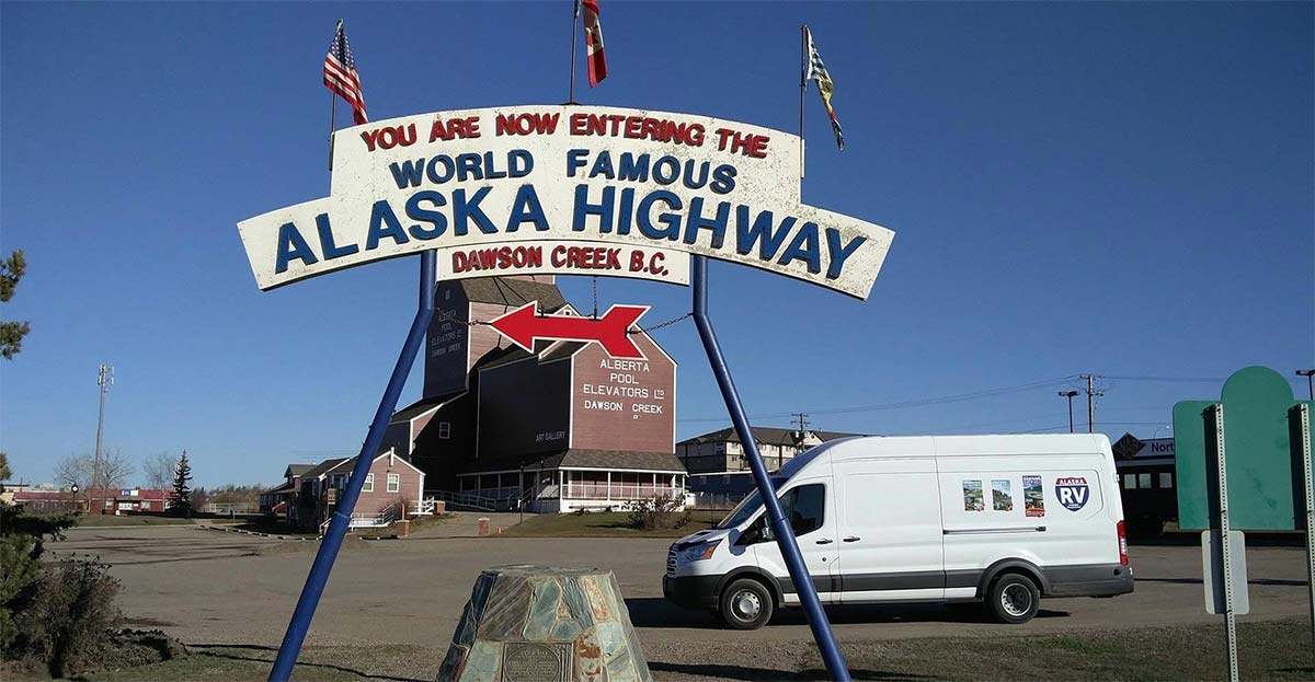
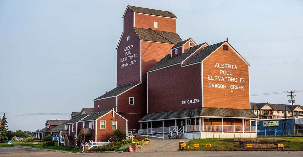
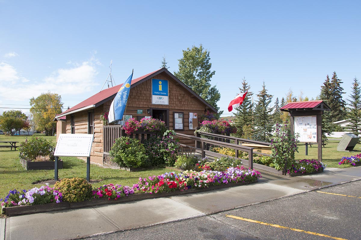
Dawson Creek
Mile 0 (km 0)
Population: 12,978 (2016)
Start of the Alaska Highway. In 1942, the ‘end of steel’ became a major terminus for troops, supplies and equipment headed to the north from Edmonton, Alberta. Be sure to stop by the Dawson Creek Visitor Centre which has historical displays and also provides up-to-date information about the Alaska Highway.


Mile 1.5 (km 2.4)
- Rotary Park – picnic and swimming
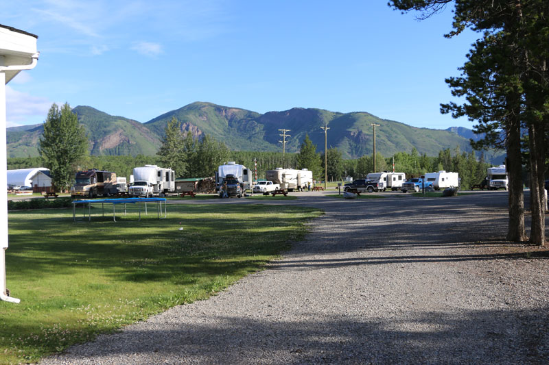
- Mile “0” RV Park & Campground
- Walter Wright Pioneer Village
Mile 1.7 (km 2.7) – Historic MP 2
Turnout with information about Alaska Highway telephone system constructed by the U.S. Army in 1942-43.
Mile 2.0 (km 3.2)
Dawson Creek Golf & Country Club, located on the left. Usually opens beginning of April each year.
Mile 8.7 (km 14)
Farmington Fairways on the right hand side. Offers overnight RV Parking along with a nine hole par 36 golf course, driving range, licensed clubhouse and golfing gear rentals. The campground has pull throughs with hook-ups, fire pits, tables and dump station.
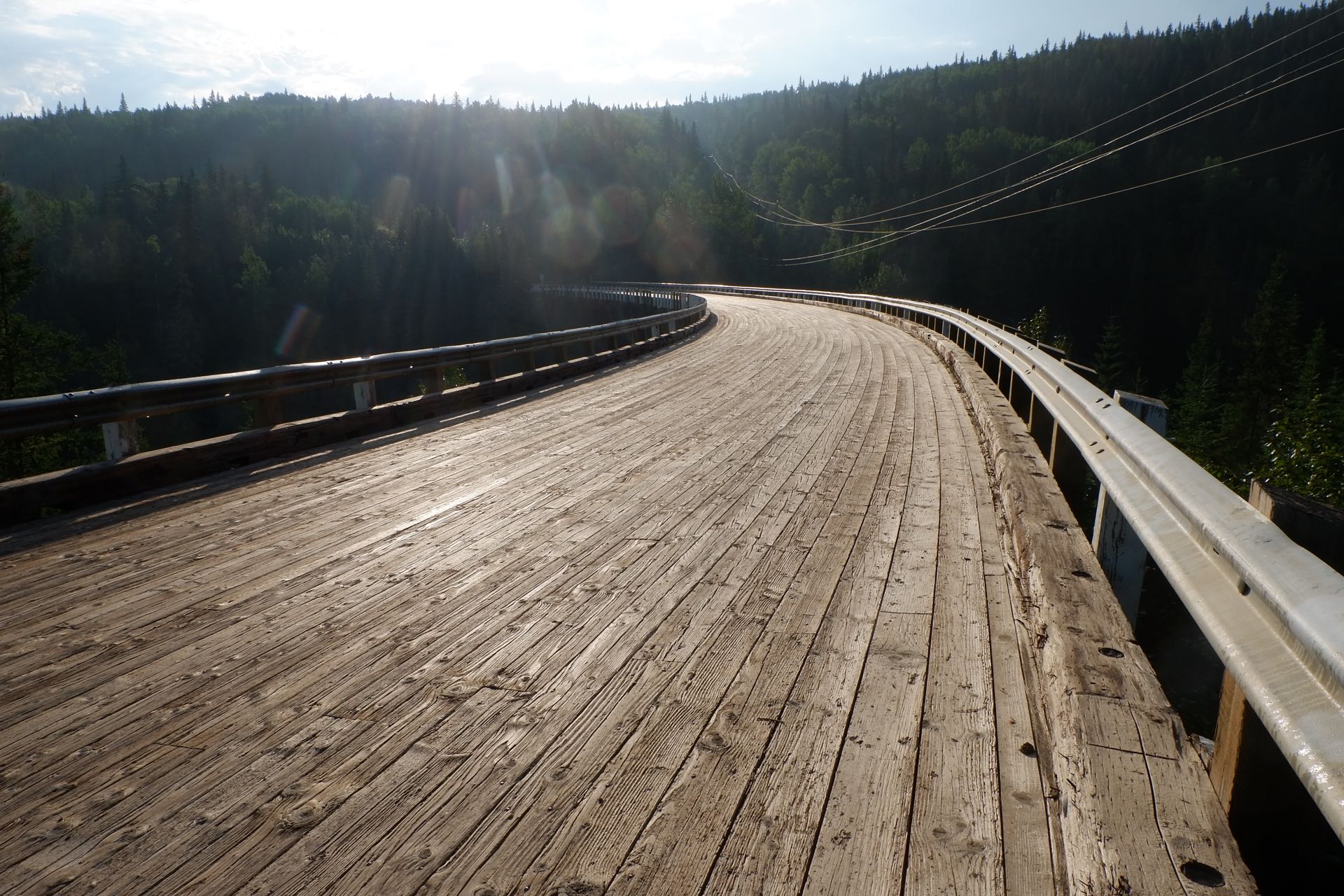
Mile 17.3 (km 27.8)
Exit to the Old Alaska Highway and Historic Kiskatinaw Curved Bridge and Kiskatinaw Provincial Park.
Constructed in 1942-43, this 534 ft. long bridge was the first of its kind in Canada and is now the only curved, banked trestle bridge in Western Canada.
Kiskatinaw Provincial Park is 3 miles/4.9 km from the exit to the Old Alaska Highway. Situated along the banks of the Kiskatinaw River. Established May 1, 1962 it features 28 camp sites, South access, 5 km. 28 camp sites, water, firewood, picnic tables, non-flush toilets and fishing. The park envelopes 58 hectares of the Peace Lowland Ecosection set in Boreal White and Black Spruce tree forest. It’s primary use is to provide local residents with a weekend recreational area to enjoy.
Another 3 miles/ 4.9 km from the campground will bring you back to the Alaska Highway.


Mile 34.2 (km 55.1)
Peace Island Park with campsites. Run by the district of Taylor it features over 100 sites for campers, tenters and rvers. Sites offered are serviced or not serviced including pull throughs with power.
Mile 34.4 (km 55.4)
Peace River Bridge
A suspension bridge was opened in 1943, replacing a ferry crossing. The bridge collapsed in 1957 due to a landslide at the north abutment. The 2,198 ft. long replacement bridge is the longest span on the Alaska Highway.
After you cross the bridge you’ll see the Younger Extraction Plant. It processes natural gas to recover natural gas liquids. It straddles a high-volume pipeline that transports natural gas to southern markets (Vancouver & Lower Mainland).
Taylor
Mile 36 (km 56.3) – Historic MP 35
Population: 1,300
Be sure to stop by the Visitor Information Centre in Taylor. It’s the tiny log structure that feature lots of information on the local history and sights to see. The building features a unique Gold Panner statue.
Taylor has a free municipal dump station and potable water, located behind the North Taylor Inn.
Lone Wolf Golf Club – 18-hole golf course and driving range.

Fort St. John
Mile 47 (km 75.6) – Historic MP 47
Population: 20,155
Late in the 18th century forts were established along the Peace River to service fur traders, then a population boom in 1942 as an Alaska Highway construction camp. Today Fort St. John is a transportation hub for the Peace River region and Northern B.C.’s Oil & Gas Capital. The visitor centre has WiFi and computer access for visitors.
Mile 48.6 (km 78.2) – Historic MP 49
Camp Alcan
The southern sector HQ for the U.S. Military during The Alaska Highway construction.
Mile 49.2 (km 79.6)
Beatton Provincial Park campground. Park is located thirteen kilometres northwest of Fort St. John on the 244 road, about a 20 minute drive.
Mile 51 (km 82.4)
Rotary R.V. Park and Charlie Lake Memorial Monument
Mile 51.3 (km 82.9) – Historic Mile 52
Charlie Lake
A supply depot for points north during the highway construction. Twelve American soldiers stationed at Charlie Lake died in May 1942 when their pontoon boat sank.
Mile 53.6 (km 86.3)
Junction with Highway 29
Mile 53.6 (km 86.3)
Charlie Lake Provincial Park campground
No Results Found
The page you requested could not be found. Try refining your search, or use the navigation above to locate the post.
Mile 71.7 (km 115.4)
The Shepherd’s Inn
Mile 72.8 (km 117.1) – Historic MP 73
Beatton River Flight Strip
One of four gravel air strips built for USAF aircraft in WWII.
Mile 79.1 (km 127.3) – Historic MP 80
Rest Area southbound
Mile 101 (km 161.7) – Historic MP 101
Wonowon, the site of a military control gate operated through the war years
Pink Mountain
Mile 140.4 (km 225.9) – Historic MP 143
Population: 100
Mile 145.1 (km 233.4) – Historic MP 148
Suicide Hill. Use the pullout to view the information signs about this treacherous hill on the original highway that was marked with a sign: “Prepare to Meet Thy Maker.”

Mile 156 (km 251)
Sikanni Hill – Rest Area and Brake Check
Mile 159.4 (km 256.5) – Historic MP 62
Sikanni River Campground & RV Park
Mile 173.3 (km 278.4)
Buckinghorse River Wayside Provincial Park campground
Mile 173.4 (km 279) – Historic MP 175
Buckinghorse River Lodge
Mile 176 (km 282.3) – Historic MP 191
South end of the Trutch Mountain Bypass that traverses the Minnaker River Valley. The bypass eliminated miles of the steep, winding highway. Trutch Mountain Summit was the second highest summit (4,134 ft) on the original highway.
Mile 198 (km 319) – Trutch Rest Area
Excellent public bathroom facilities and cell service provided at this site. Part of the Peace River Regional District’s the Gotta Go service.
Mile 227 (km 364.7) – Historic MP 234
Adsett Creek pullout – This is the start of the 1992 Adsett Creek Highway Realignment that straightened 41 miles of the original highway between mile 234 and 275.
Mile 265.5 (km 426.5)
Andy Bailey Regional Park – 5 small campsites
Fort Nelson
Mile 283 (km 454.3) – Historic MP 300
Population: 4,900
Fort Nelson was established in 1805 by the North West Fur Trading Company. During the 1940s the community grew quickly due to construction of the highway. Today Fort Nelson is a full-service community that meets the needs of B.C.’s oil and gas industry.
Mile 301 (km 483.5)
Junction with the Liard Highway to the Northwest Territories
Mile 318.7 (km 509.5)
Kleedo Creek wayside rest area
Mile 335.7 (km 536.8)
Steamboat Mountain Brake check and rest area
Mile 343.2 (km 548.9)
Teetering Rock viewpoint and trailhead for 7.6 mile steep and challenging hiking trail.
Mile 344.7 (km 551.4)
Tetsa River Campground Regional Park
Mile 357.5 (km 571.7) – Historic MP 375
Tetsa River Lodge and Campground
Mile 371.5 (km 594.2)
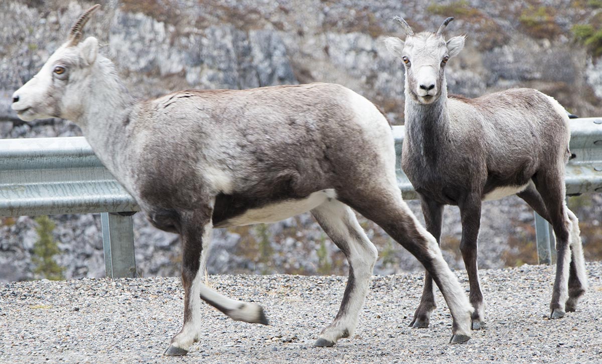
Start of Stone Mountain Provincial Park, watch for stone sheep on the highway.
Mile 373.6 (km 597.6) – Historic MP 392
- Summit Pass is the highest summit on the Alaska Highway at 4,250 ft.
- Summit Lake/Stone Mountain Provincial Campground
Mile 404.6 (km 647.4) – Historic MP 422
Toad River Lodge

Mile 408.8 (km 658) – Folded Mountain
Originally, all the rock of the Canadian Rockies lay flat on the shallow sea bed of the western continental shelf, where it had accumulated grain-by grain for over a billion years. About 175 million years ago, the continent of North America began to move westward, overriding the Pacific floor and colliding with offshore chains of islands.
The continental shelf was caught in the squeeze. The flat-lying layers slowly buckled into folds like those you see here. As time passed, folded mountain ranges sprang up across British Columbia. By 120 million years age, the Rockies were showing above the sea. They grew for another 75 millions years, rising faster than erosion could tear them down – likely reaching Himalayan heights. Active mountain building ended in the Canadian rockies 45 million years ago. The peaks have eroded to a small fraction of their original size.
Mile 436.5 (km 698.5) – Historic MP 456
Pullout with information about Muncho Lake and the Checkpoint here during Alaska Highway construction. There was a much rock removed for the original highway above the lake and the new route along the lake’s edge.
Mile 436.9 (km 699.2)
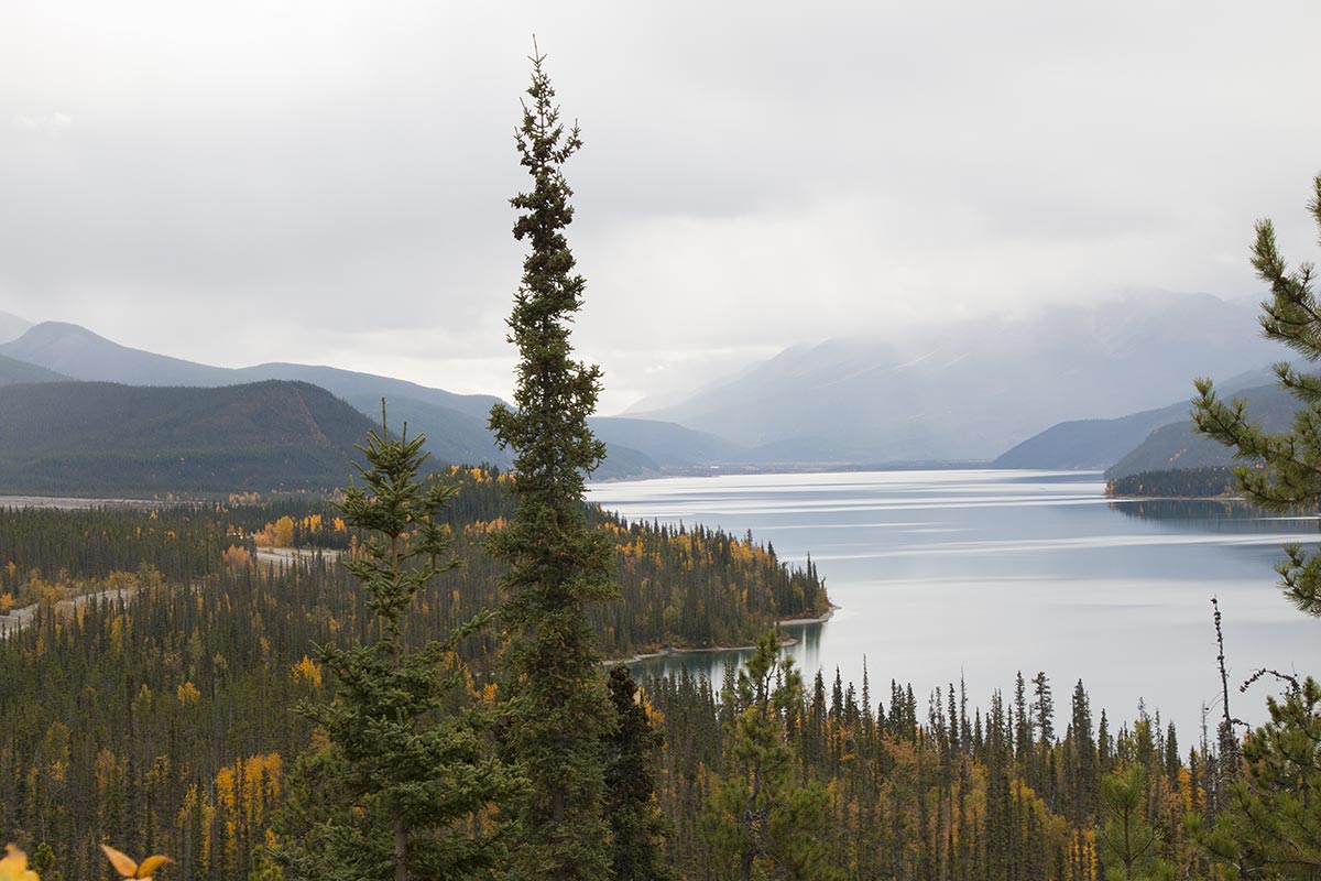
Muncho Lake
Mile 437.7 (km 700.5) – Muncho Lake
Strawberry Flats Campground – Muncho Lake Provincial Park.
Mile 442.2 (km 707.0) – Historic Mile 462
Northern Rockies Lodge with RV Park
Mile 442.9 (km 709) – Muncho Lake
MacDonald Campground – Muncho Lake Provincial Park
Mile 443.6 (km 710.1) – Historic Mile 463
Munch Lake RV Park
Mile 444.9 (km 712.2) – Historic Mile 463
Muncho Lake viewpoint with large parking area.
Mile 454 (km 729.7)
Mineral Lick – Short hiking trail with views of Trout River; the river’s salty banks are popular with sheep, goats, caribou and elk.
Mile 456 (km 733.8)
Double “G” Service Lodging & Café
Mile 477.7 (km 764.7) – Historic MP 496
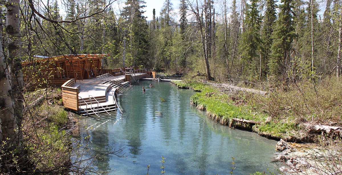
Liard River Hotsprings Provincial Park and campground
Liard Hotsprings are the second largest hot springs in Canada and well worth a stop.
The hotsprings were popular long before highway construction crews arrived. Now a very popular stop for highway travellers, the springs are the second largest natural hot springs in Canada. Watch for Wood Bison on the highway!
The hot springs are also fantastic in the winter.
Mile 477.8 (km 764.0) – Historic MP 497
Liard Hotsprings Lodge – Conveniently located within walking distance to the Liard Hot Springs. Offers restaurant, dining and rooms, RV Park and Campground, cabin rentals, and a convenience store with Gas & Diesel.

Mile 533 (km 857.8)
Coal River Lodge & RV
Mile 550.9 (km 880) – Historic MP 570
Allen’s Lookout and Rest Area, a large circular pullout with good views of the Liard River. Numerous information signs about the local bison herds and history of the area.
Mile 567.9 (km 909.4) – Historic MP 588
Contact Creek and a pullout with information of the connection of the southern section of the Alaska Highway in September 1942 when construction crews met here.
Mile 570 (km 912.9) – Historic MP 590
Contact Creek Lodge
Mile 605 (km 967.8) – Historic MP 627
B.C. / Yukon Border
There are no signs marking this official crossing into Yukon. Look for the sign nearer Watson Lake. Travellers will cross the border numerous times before making the final crossing into Yukon.
Yukon
Watson Lake
Mile 612.9 (km 980) – Historic MP 635
Population: 800
The Gateway to the Yukon – a major staging point during highway construction, a full-service community today. In 1942, a simple sign pointing home to Illinois spawned an ever-growing forest of signs, the Watson Lake Sign Post Forest historic site. The Watson Lake airport was one of the original airfields along the Northwest Staging Route.
Travellers heading to Ross River, Faro and Carmacks via the Campbell Highway turn north here; check road conditions before taking this route.
Mile 615.3 (km 984)
Watson Lake Yukon government campground
Mile 620.2 (km 991.7) – Historic MP 642
Upper Liard Village
Mile 626.2 (km 1001.6) – Historic MP 649
Junction with the Cassiar Highway (Hwy 37).
Mile 627 (km 1002.8) – Historic MP 650
The Northern Beaver Post/Nugget City and RV campground.
Mile 627.3 (km1003.4)
Rest Area with information signs and maps of the area highways.
Mile 651.2 (km 1042.2)
Big Creek Yukon government campground.
Mile 664.1 (km 1052.7)
Transport Rest Area
Mile 677 (km 1083.7)
Rancheria River – viewpoint and trailhead for a path to the Rancheria River.
Mile 687.2 (km 1100) – Historic MP 710
Rancheria Lodge, the first of the highway lodges to serve travellers on the pioneer highway after WWII. The lodge is now closed.
Mile 695.2 (km 1112.8)
Rancheria Falls Recreation Site with a well-maintained path to the falls.
Mile 698.4 (km 1118) – Historic MP 721
Continental Divide Lodge
Mile 699.4 (km 1120)
Continental Divide – pullout with information signs about the ridgeline that separates two of the largest river drainages in North America: the Yukon River and Mackenzie River watersheds.
Mile 710.3 (km 1137.4) – Historic MP 733.5
Re-enter British Columbia for about 42 miles northbound.
Mile 719.6 (km 1152)
Swan Lake Rest Area and viewpoint overlooking the granite remains of an ancient land known as Quesnellia.
Mile 751.2 (km 1202)
Northbound travellers re-enter Yukon for the last time.
Mile 752 (km 1204)
Morley River Recreation Site and rest area.
Mile 776 (km 1243)
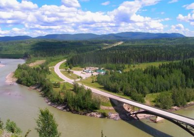
Nisutlin Bay Bridge, this 917 ft. long bridge crosses the widest water span on the highway. One of only three permanent steel bridges on the Alaska Highway built by the US Army Corps of Engineers. It was the second highest bridge on the highway and was completed in 1944 for $1,200,000.

Mile 776.3 (km 1243.5) – Historic MP 804
Yukon Motel and Lakeshore RV Park
Teslin/Deisleen Aayi
Mile 776.5 (km 1244) – Historic MP 804
Population: 450
Teslin originated as a trading post in 1903. The George Johnston Museum and Teslin Tlingit Heritage Centre provide insight to the area’s historical and First Nations’ significance.
Mile 785.2 (km 1257.9)
Teslin Lake Yukon government campground
Mile 797.6 (km 1278)
Timber Point Campground
Mile 808.2 (km 1295)
Junction with the historical South Canol Road that leads to Ross River. There’s a pleasant and large rest area just a few hundred feet in with some WWII vehicles on display and information signage about the 1942-44 Canol Project.
Mile 808.0 (km 1296.2) – Historic MP 836
Johnson’s Crossing
No Results Found
The page you requested could not be found. Try refining your search, or use the navigation above to locate the post.
Mile 821 (km 1315.9)
Squanga Lake Yukon government campground.
Mile 825.8 (km 1329)
Beginning of the Southern Lakes Region, home to more than a dozen major lakes and the headwaters of the Yukon River.
Mile 836.8 (km 1341.5) – Historic MP 866
Jake’s Corner and junction with Tagish Road to Carcross and Atlin B.C.
Mile 840 (km 1352) – Historic MP 866
Marsh Lake, a popular cottage community along with a community centre and vacation rentals. Numerous boat launches in the area provide access to the popular lake.
Mile 859.9 (km 1379) – Historic Mile 890
Marsh Lake Yukon government campground
Mile 860 (km 1379.1)
Marsh Lake Recreation Site
Mile 873.5 (km 1403) – Historic MP 904
Caribou RV Park
Mile 874.4 (km 1404.4) – Historic MP 904
Junction with the South Klondike Highway to Carcross and Skagway
Mile 876.8 (km 1408.2) – Historic MP 906
Wolf Creek Yukon government campground
Mile 880 (km 1413.6)
Fireweed R.V. Services
Mile 882.2 (km 1415)
Pioneer RV Park


Mile 882.7 (km 1417.8)
Philmar RV Service and Supply
Mile 882.9 (km 1418.1)
Mountain Ridge Motel and RV Park (closed)
Mile 883.7 (km 1419.4)
Hi Country R.V. Park
Whitehorse, Yukon’s capital city
Mile 887.4 (km 1425.5) – Historic MP 918
Population: 27,000
Whitehorse was established in 1898. Since its beginning, the city has been a heavily-used transportation hub, first with the White Pass & Yukon Route railway, then the river stern-wheelers plying the Yukon River.
During highway construction in the 1940s, Whitehorse was HQ for the northwestern portion of the Alaska Highway and home to thousands of American military and civilian workers. When the highway opened to civilian travel, Whitehorse continued to thrive.
Whitehorse replaced Dawson City as capital of Yukon in 1953, and is now the largest community on the highway. There are many excursions and amenities available, including major grocery stores like Walmart, Superstore, Save-On-Foods, Wyke’s Independents, Canadian Tire and also shops specializing in RV Repair.

Mile 894.6 (km 1436.3)
Rest area
Mile 894.8 (km 1437)
Junction with the North Klondike Highway to Dawson City
Mile 905.4 (km 1454.1) – Historic MP 937
Dawson Trail and Takhini River viewpoint
Mile 926 (km 1487)
Takhini Burn Rest Area, more than 1.5 million acres burned during a 1958 forest fire.
Mile 927.3 (km 1489.2) – Historic MP 960
Junction with the road to Kusawa Lake Yukon government campground. The 15-mile long narrow gravel road passes by historical Mendenhall Landing and the Takhini River Yukon government campground. The 45-mile long Kusawa Lake is popular with fishermen. Be prepared for high winds and fast-changing weather.
No Results Found
The page you requested could not be found. Try refining your search, or use the navigation above to locate the post.
Mile 964.7 (km 1546) – Historic MP 995
Otter Falls Cutoff – store, fuel, RV Park, restaurant
Mile 964.7 (km 1546) – Historic MP 995
Junction with 73-mile long Aishihik Road. Aishihik was an airfield on the North West Staging Route. At mile 17 is Otter Falls, made famous on a Canadian 5-dollar bill. Aishihik Lake Yukon government campground is at mile 26. The gravel road can be rough to the campground and is rougher past the campground.
Mile 965.6 (km 1547.5) – Historic MP 996
Canyon Creek Bridge rest area
Mile 976.9 (km 1566)
Mt. Kennedy and Mt. Hubbard viewpoint and rest area
Mil 980.8 (km 1572.1)
Pine Lake Yukon government campground
Mile 984.7 (km 1578)
Kluane National Park and Haines Junction Visitor Centre in the Da Kμ Cultural Centre
Haines Junction
Mile 985 (km 1578.5) – Historic MP 1016
Population: 840
Be sure to turn right to continue north on the Alaska Highway. Or carry on straight if you’re headed south to Haines, Alaska.
Our Lady of the Way Catholic Mission was built in 1943 using an abandoned U.S. Army Quonset hut; look for this historical structure on your right as you head to Alaska.
Mile 988.3 (km 1584)
Haines Junction rest area
Mile 999 (km 1596.7)
Spruce Beetle Trail Interpretive Site and hiking trail
Mile 1000.1 (km 1598.6)
Bear Summit – 3,294 ft., the highest point on the Alaska Highway between Whitehorse and Fairbanks
Mile 1019.5 (km 1633)
Boutillier Summit – 3,293 ft., the second highest point between Whitehorse and Fairbanks
Mile 1020 (km 1635)
Kluane Lake viewpoint and rest area
Mile 1028.8 (km 1649.1)
Tachal Dhal Visitor Centre at the base of Sheep Mountain (Tachal Dhal). Check in at the visitor center if you plan to hike or explore the backcountry of Kluane National Park.
Mile 1029.7 (km 1650.8) – Historic MP 1061
Soldiers’ Summit
The Alaska Canada Military Highway was officially opened at Soldier’s Summit on November 20, 1942. A hiking trail to the ceremony site follows the original highway route. Information signs along the trail provide historical information.
Mile 1034.5 (km 1658.3)
Cottonwood RV Park
Mile 1039.5 (km 1666)
Congdon Creek Yukon government campground
Destruction Bay
Mile 1046.7 (km 1684.5) – Historic MP 1083
Population: 55
A small community with fuel, camping and lodging. Named for the wind that blew down structures put up by the army during highway construction in 1942.
Mile 1051.2 (km 1691.7)
Destruction Bay rest area
Burwash Landing
Mile 1061 (km 1707.5)
Population: 85
Originally a trading post established in 1903. Today Burwash is home to the Kluane Museum of Natural History with wildlife exhibits and informative displays about the area and its peoples.
Mile 1076.6 (km 1732)
Kluane River Overlook & rest area. Lieutenant Small Memorial – Roland Small was one of five fatalities suffered by the US Army 18th Engineers during the construction of the Alaska Highway.
Mile 1083.4 (km 1737) – Historic MP 1118
Kluane Wilderness Village
Mile 1117.1 (km 1791.1) – Historic MP 1152
Lake Creek Yukon government campground
Mile 1129 (km 1818)
Discovery Yukon Lodgings – open during the summer months offers RV Park & Campground, cabins, convenience items and restaurant.
Mile 1153.3 (km 1849.2) – Historic MP 1188
Junction with Snag Road. Snag was an airfield on the North West Staging Route known for having the coldest recorded temperature in North America, at -81.4˚ F in February 1947. Snag Road is a 15-mile long narrow dirt road best travelled with a four-wheel drive.
Mile 1153.4 (km 1849.6)
Snag Junction Yukon government campground
Beaver Creek
Mile 1166.5 (km 1870.6) – Historic MP 1202
Population: 110
The small settlement was started about 1955 and had a Post Office in 1958. Canada Customs and other businesses have enlarged the community since then. Canadian customs is located north of town beside the airport. This place is also the scene of the contact point of the northern and southern construction crews building the Alaska Highway. On 20 October 1942 bulldozer operator Cpl. Refine Sims Jr. of Philadelphia and the 18th US Army Engineers was working south on the section from Fairbanks. He met his opposite number, Pte. Alfred Jalufka of Kennedy,Texas and the 97th Engineers, who was working north from Whitehorse. An excellent tourist information center is located in the small community, which also has fuel, camping and lodging.
No Results Found
The page you requested could not be found. Try refining your search, or use the navigation above to locate the post.
Mile 1168.5 (km 1873.8)
Beaver Creek Canada Customs station. Open 24/7 year-round.
Ph: 867-862-7230
Mile 1186.3 (km 1902.5) – Historic MP 1221
Rest area and border signs
Alaska / Yukon border crossing
The photo below shows typical construction work being done along the Alaska Highway, north of Beaver Creek. Each year the highway department tackles the never ending task of highway maintenance. Usually involves regrading gravel and then applying the chipseal on top.


Alaska
The mileposts in Alaska indicate the historical mileages from Mile 0 rather than today’s mileage from Dawson Creek. Note the time change; set your clocks back one hour.
In Alaska, the Alaska Highway meets with the Taylor Highway (which heads north towards Chicken, Eagle and Dawson City) at Tetlin Junction and ends at Delta Junction, where you can continue on the Richardson Highway (west towards Fairbanks or south towards Glennallen).
Mile 1186.8 – Historic MP 1221.8
Port Alcan U.S. Customs and Border Protection station. Open 24/7 year-round.
Ph: 907-774-2252
Mile 1190.5 – Historic MP 1225.5
Mile 1194 – Historic MP 1229
Tetlin National Wildlife Refuge Visitor Center
Open mid-May to mid-September
Mile 1214 – Historic MP 1249.3
Deadman Lake Campground – Tetlin Refuge campground
Mile 1222 – Historic MP 1256.7
Lakeview Campground – Tetlin Refuge campground
Mile 1229 – Historic MP 1264
Northway Junction
Mile 1254 – Historic MP 1289.5
Rest area with views of Wrangell Mountains to the west.
Mile 1267 – Historic MP 1301.7
Tetlin Junction
Junction with the Taylor Highway to Chicken, Eagle and Yukon border.
Mile 1268 – Historic MP 1303
Tanana River Bridge rest area
Mile 1274 – Historic MP 1309.2
Tok River State Recreation Site campground
Tok
Mile 1279 – Historic MP 1314
Population: 1,450
Tok originated as an Alaska Road Commission camp for the construction of the Alcan and Glenn Highways in the 1940s. Tok is now a full-service community with fuel, camping, lodging, groceries and repair facilities. Continue straight through town on the Alaska Highway to Delta Junction and Fairbanks. Turn left on the Tok Cutoff if you want to head to Anchorage or Valdez.
Visitor information is available at the Alaska Public Lands Information Center in the State Troopers building east of Milepost 1314, or at the Mainstreet Visitor’s Center at the junction of the Alaska Highway and Tok Cutoff.
Mile 1296.9 – Historic MP 1331.9
Moon Lake State Recreation Site
Mile 1303.5 – Historic MP 1338.5
Cathedral Creeks B&B and Campground
Mile 1309 – Historic MP 1334.5
Rest area with views of Alaska Range and information about the Tanana River and area.


Mile 1379.8 – Historic MP 1414.8
Clearwater State Recreation Site
Mile 1380 – Historic MP 1414.8
Clearwater State Recreation Site
Mile 1386 – Historic MP 1421
Snowed Inn RV Park
Delta Junction
Mile 1387 – Historic MP 1422
Population: 984
This is the end of the Alaska Highway. Travellers continue towards Fairbanks on the Richardson Highway or turn south on the Richardson Highway towards Glenallen and Valdez.
The Delta Junction Visitor Center has an end of highway monument that is a good photo stop. The center also has certificates for those who have survived driving the Alaska Highway.
To continue to Fairbanks from Delta Junction, refer to the Richardson Highway log starting at Mile 266, the junction of the Richardson Highway with the Alaska Highway.

Alaska Highway History
Spanning 1,400 miles and running through some of the most scenic lands in North America…
Caption for top left photo: Construction of the Johnson’s Crossing Bridge on Alaska Highway, about 90 miles south of Whitehorse. The bridge crosses Teslin River 2 miles below Teslin Lake.
Photo Courtesy of Johnson’s Crossing Lodge.
Since the early 1900’s various groups in Canada and the US had pressed for a highway to Alaska. In 1930 the US government established the Alaska International Highway Commission and in 1931 a similar body was set up by the Canadian government to study the location, financing and construction of such a road.
Finally, two major routes were chosen. Route “A” started from Vancouver,B.C. and went through Prince George, Hazelton, Telegraph Creek and Atlin and on to Whitehorse: 1275 miles approximately. Route “B” went through Prince George, Fort St. James, Dease Lake and Atlin to Whitehorse: 1250 miles approximately. Several other routes were proposed for special or local reasons. The major reason advanced for constructing the road was the advantage of a land link to Alaska in time of war. The major problem was always financing.
In February 1942, the American armed forces, ignoring all previous plans and studies, chose the present and, until then, unconsidered route. The need for an access and service road for the string of airfields being built between Edmonton and Fairbanks to supply Russia with aircraft was immediate; local and future economic needs of the region were of secondary
importance. An agreement with the Canadian government was quickly reached.
Surveys were started the same month and by April 1942 construction had begun. Round-the-clock work by 9,000 US Army Engineers saw a usable truck road pushed through by late November. Following the troops came the civilian contractors, 77 of them: 62 American and 15 Canadian firms employed 12,000 men to bring the road up to standard by late 1943. In all, 7,000 pieces of equipment were used.
The US government paid all construction costs and the cost of maintenance up to 1 April 1946, when the Canadian section was turned over to the Canadian Army Engineers. The airfields and land communication systems were turned over to the RCAF at the same time. The road was maintained until 1965 by the Canadian Army Engineers and from that date by the Departments of Highways of the Yukon Territory and British Columbia, with Federal assistance. The total cost of the highway to 1 April 1946 was never revealed but estimates placed it above $138,000,000.
Officially and originally named the “Alaska military Highway”, the men on the job soon shortened this to “The Alcan”. Neither name was popular with the public, which had followed the construction with great interest. On 25 March 1943, Anthony J. Dimond, Congressman from Alaska, proposed the name, “The Alaska Highway”, which was officially adopted by both governments on 19 July 1943. (Dimond had been a long-time backer of Route “A:.)
The speed of construction, the location and the climate all make this project one of the great engineering feats of our time. As shorter and more economical routes are being built closer to the Pacific coast, the highway will gradually lose its overall importance but never its history or impact on the Yukon and central Alaska, where its opening heralded the end of an era.
