Haines Highway
Haines is a 146-mile drive from Haines Junction, Yukon. From the Alaska Highway, travellers will continue in Yukon for 60 miles, then British Columbia for 45 miles, and the final 41 miles in Alaska. The paved highway is well-maintained and less busy than the Alaska Highway. Southbound travellers descend from the Haines Highway Summit on the Chilkat Pass at 3,510 ft. to sea level in Haines within a 60 mile distance.
Distances are from Haines, Alaska. While driving the Haines Road, watch for Grizzly and Black bears as this is excellent bear habitat. Nearing the Haines summit, watch for Willow Ptarmigan, and you may even spot a Gyrfalcon, their main predator.

Mile 0 – Haines
Population: 2,474 (2018 estimate)
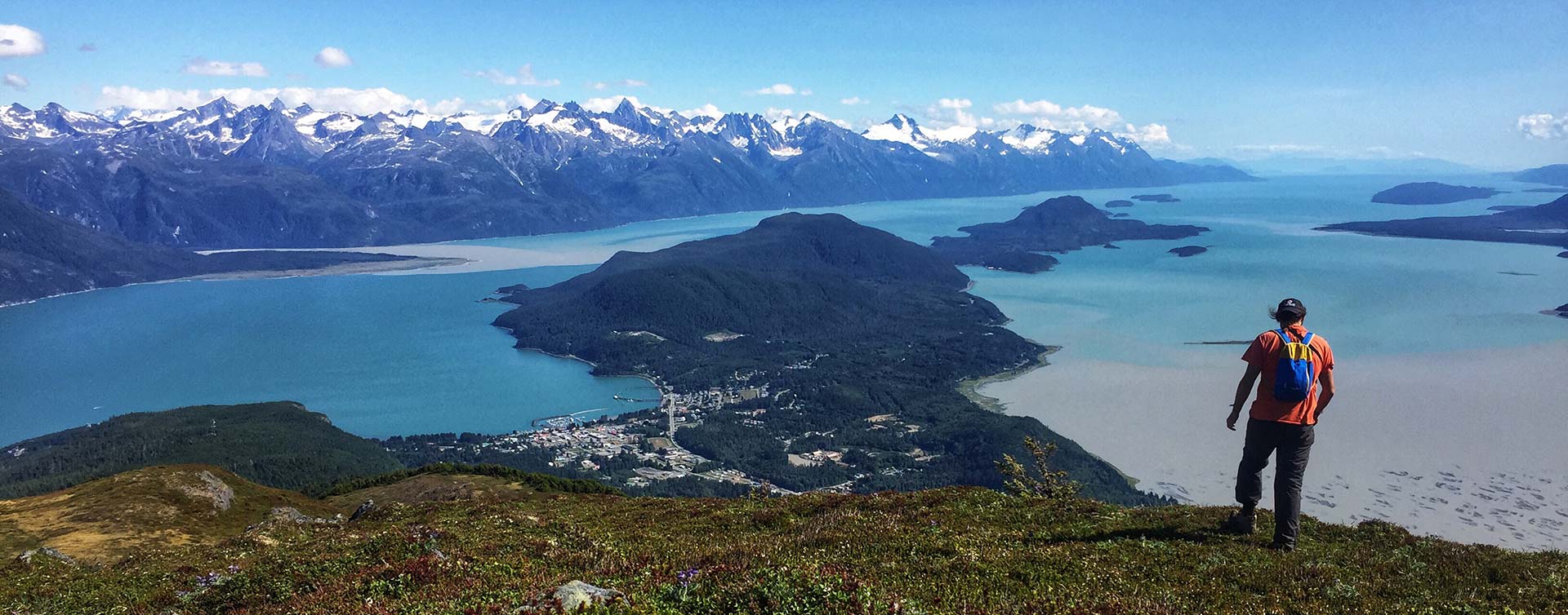
Haines is tucked in the forests of southeast Alaska on the shores of America’s longest fjord. Surrounded by spectacular peaks, glaciers, rivers, and lakes that are home to abundant birds and wildlife.
Offering an abundance of outdoor recreation, and guided excursions to suit many interests, combined with a full range of business services for visitors with restaurants, RV Parks and state campgrounds. Whatever your interest in Alaska, you’ll find it in Haines, the Alaska of your dreams!
Mile 99 – Million Dollar Falls Campground
A 500-m trail and boardwalk with railings lead to a viewing deck overlooking the falls and canyon. Look for the American Dipper bobbing in the falls or river here year-round.
Mile 100.6 – Tatshenshini River Viewpoint
A pullout on the west side of the road overlooks the beautiful Alsek mountain range and the Tatshenshini River, which was designated a Canadian Heritage River in 2005. Panels explain the early exploration and First Nation use of the area. Local companies offer guided one-day to multi-day rafting trips down this and other local rivers.
Mile 105 – Dalton Post
A popular spot for salmon fishing in the summer and fall. The Klukshu River flows into the Tatshenshini River downriver from the historic site of Shäwshe village. This river system hosts seasonal runs of Chinook, Sockeye, and Coho salmon. Chinook are most visible in July, Sockeye from August to October, and Coho in late September to October. In fall, Grizzly Bears come to feast on this bounty from the sea, so be alert to their presence. This 6-km steep dirt road requires vehicles with high clearance. Not suitable for Campers/RVs. Use caution in muddy conditions.
Mile 107.5 – Klukshu wetland overlook
A large pullout on the west side of the road overlooks two small wetlands. A dozen or so Trumpeter Swans regularly spend the summer here. It’s speculated that of these are be birds that have not mated or whose attempt to nest failed. A little more than 1 1/4 mile further north along the highway, you will pass a beautiful marsh on the west side of the road. A pair of Trumpeter Swans often nest and raise a family here.
Mile 113.1 – Klukshu River
Grizzly Bears frequent this area. A stop here and a careful scan of the area may reveal one of these bruins or signs they were in the area.
Mile 115 – St. Elias Lake
Mile 125.7 – Rock Glacier Viewpoint
Mile 136.4 – Kathleen Lake Campground
Mile 137.3 – Kathleen River Bridge
A pullout on the east side of the road provides access to the Kathleen River. There are panels here explaining fish use. From here, you can canoe into the Lower Kathleen River and Rainbow Lake. Canoeing below Rainbow Lake requires whitewater experience.
Mile 148.6 – Auriol trail
Mile 152.2 – Dezadeash River Trail
A 5.5-km trail leads you into the forest. From ducks to Moose, you may encounter a variety of animals on this easy walk. This is a good location for winter wildlife viewing as the open water attracts a variety of wildlife. The parking lot and trailhead are on the Haines Road, about 500 m south of the intersection with the Alaska Highway, on the west side of the road. Be sure to visit the swallow houses and interpretive signs visible from the parking lot.
