George Parks Highway,
Alaska Road Log
Parks Highway
Anchorage to Fairbanks – 358 miles (576.1 km)
The George Parks Highway (commonly referred to as the Parks Highway) begins 35 miles (56.3 km) north of Anchorage at the junction of the Glenn Highway. This log uses Anchorage as Mile 0.
It’s a fully paved, wide and well-maintained route that is open year-round.
The highway, which parallels the Alaska Railroad, is the main route between Anchorage and Fairbanks. It travels over rugged terrain and crosses over 40 bridges.
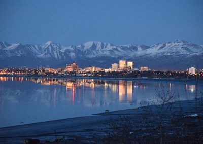
Anchorage
Mile 0: Population: 291,845
Mile 4.2 (km 6.7): Take Muldoon Road exit to visit Alaska Native Heritage Center.
Mile 11.6 (km 18.6): Exit to Eagle River Campground, Chugach State Park.
Mile 13.4 (km 21.5): Exit to Chugiak and Eagle River.
Mile 35 (km 56.3)
Junction of the Glenn Highway and Parks Highway
Mile 36 (km 57.9)
Mat-Su Visitor Center Mat-Su Visitor Center
Ph: 907-746-5000
Mile 37.8 (km 60.8)
Big Bear RV Park & Campground
Mile 39.3 (km 63.2)
Seward Meridian Road Meridian Center Mall and Walmart
Mile 41.5 (km 66.7)
Junction with Palmer-Wasilla Highway
Mile 42.2 (km 67.9)
Junction with Knik-Goose Bay Road to Iditarod Trail Headquarters
Wasilla
Mile 42.2 (km 67.9)
Population: 8,736
Visitor Information and access to Hatcher Pass via Main Street
Mile 47 (km 75.6)
The Museum of Alaska Transportation and Industry
Mile 52.2 (km 84)
Junction with Big Lake Road to Big Lake Recreation area
Mile 57 (km 91.7)
Bridge over Little Susitna River, parking
Mile 57.3 (km 92.2)
Little Susitna River Campground
Houston
Mile 57.4 (km 92.3)
Population: 2,112
Mile 57.5 (km 92.5)
Miller’s Place with camping
Mile 57.7 (km 92.8)
Riverside Camper Park
Mile 66.5 (km 107)
Nancy Lake State Recreation Site and campground
Mile 67.2 (km 108.1)
Nancy Lake State Recreation Area with the South Rolly Lake Campground
Willow
Mile 69.5 (km 111.8)
Population: 2,141
Mile 70.8 (km 113.9)
Willow Creek State Recreation Area and campground.
Mile 71.2 (km 114.5)
Junction with Hatcher Pass Road, a scenic 49 mile long narrow, gravel road. Not recommended for large RVs or trailers.
Mile 71.5 (km 115)
Willow Creek Resort.
Mile 82.5 (km 132.7)
No Results Found
The page you requested could not be found. Try refining your search, or use the navigation above to locate the post.
Mile 87.9 (km 141.4)
Gigglewood Lakeside Inn.
Mile 96.4 (km 155.1)
Montana Creek Campground.
Mile 98.8 (km 159)
Junction with 14 mile long road to Talkeetna.
Talkeetna
Population: 931
Talkeetna is a historic village nestled at the base of Mt. McKinley (Denali) with panoramic views of the Alaska Range. The town is located at the end of the paved 14-mile-long Talkeetna Spur Road. Visitor Information and services available in Talkeetna.
Mile 113.1 Welcome sign to Trapper Creek.
Mile 114.4 (km 184.1)
Devonshire Road access. Traveling north on the Parks Highway, make a left turn onto E. Devonshire Rd. Yield, as the left turn is an un-controlled intersection. Open 24/7 year-round is the Trapper Creek Watering Point. This newly constructed facility is lighted with security and accepts quarters, ones, fives, tens, twenties, and major credit cards for your water fill-up needs. $0.13/gallon.
Mile 114.6 (km 184.4)
3 Bears (formerly Trapper Creek Inn & RV Park).
Mile 114.6 (km 184.4)
Petersville Road junction. Provides access to Petersville Recreational Mining Area.
Trapper Creek
Mile 115 (km 185)
Population: 456
Mile 133 (km 214)
Mt. McKinley Princess Wilderness Lodge
Mile 134.8 (km 216.9)
Denali Viewpoint South with an excellent view of Denali and overnight parking (fee).
Mile 135 (km 217.2)
Views of Denali can be seen at several spots along the highway, particularly at the Willow and the Denali Viewpoint.
Mile 137.2 (220.8)
Lower Troublesome Creek – Denali State park campground
Mile 147 (km 236.5)
Byers Lake – Denali State Park campground
Mile 147.1 (km 236.7)
Alaska Veterans Memorial, rest area and visitor information
Mile 162.4 (km 261.3)
Denali Viewpoint North
Mile 162.7 (km 261.8)
Denali View North, overnight parking for a fee
Mile 185.8 (km 299)
East Fork Chulitna Wayside with overnight parking
Mile 201.3 (km 323.9)
Broad Pass Summit – 2, 409 ft.
Mile 209.9 (km 337.8)
Junction with the Denali Highway, a 133-mile gravel road east to Paxson on the Richardson Highway
Cantwell
Mile 210 (km 337.9)
Population: 191
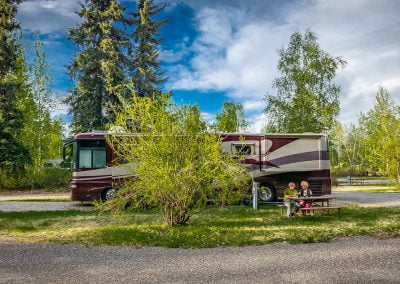
Cantwell RV Park
Mile 229.1 (km 368.7)
Denali Air – flightseeing
Mile 231.1 (km 371.9)
Denali Grizzly Bear Resort.
Mile 238 (km 383)
The community of Denali Park offers many visitor services and numerous camping facilities
Mile 240 (km 386.2)
Entrance to Denali National Park
Mile 245.1 (Km 394.4)
Denali RV Park & Motel.
Mile 248.5 (km 399.9)
Midnight Sun RV & Campground
Healy
Mile 248.7 (km 400.2)
Population 1,093
Mile 269 (km 432.9)
Rest Area
Mile 276 (km 444.1)
Tatlanika Trading Co. and RV Park
Mile 283.5 (km 456.2)
Junction with access road to Anderson, which has a Riverside City Park with campground on the Nenana River.
Nenana
Mile 304.5 (km 490)
Population: 362
Mile 305 (km 490.8)
Alaska Veterans’ Honor Bridge over the Tanana River, large paved parking at the north end of bridge
Mile 318.7 (km 512.8)
Viewpoint for Denali
Mile 351.2 (km 565.2)
Turn-off for Ester
Population: 2,040
Mile 356.8 (km 574.2)
Turn-off to the University of Alaska
Mile 357.8 (km 575.8)
Exit to Fairbanks International Airport
Fairbanks
Mile 358 (km 576.1)
Population: city-30,955 borough-95,898
Take Airport Way to go downtown or continue straight for the Richardson Highway to Delta Junction and the Alaska Highway.


